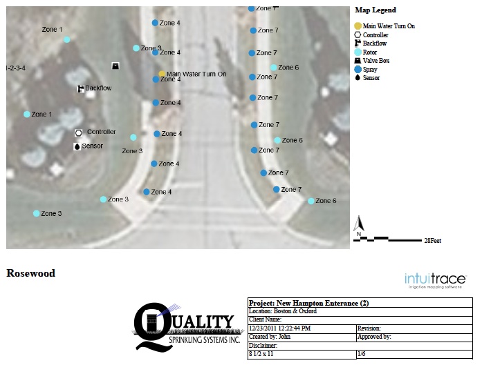
GPS Irrigation Mapping takes the guess work out of maintenance using GPS technology.
Saving time and money by improving communication between clients and contractors. Providing you with an accurate map of your commercial or residential property.
Ideal for:
- map components such as heads and valves
- capture photographs (with GPS coordinates) of backflow and controllers
- map pipe locations
- capture photographs (with GPS coordinates) of surface catch basins
Low Voltage Landscape Lighting
- map wire path and fixture locations
- map wire and pipe path
- map wire path
- map location and label species
- capture photographs (with GPS coordinates) of trees
